$2,697
3411 S La Cienega Boulevard, Los Angeles, CA 90016(323) 918-4134Rent Savings
- 88 units available
- Studio • 1 bed • 2 bed
- Amenities
Patio / balcony, Pet friendly, Parking, Gym, Pool, Dog park + more
Verified listing
Verified

After a 20% drop in homicides citywide, more Angelenos are actively searching for peace of mind, not just price per square foot. In a city as sprawling and diverse as Los Angeles, safety ranks alongside rent and commute times as a top priority for renters. Whether you’re a first-time apartment hunter or looking to relocate within the city, knowing which areas have low crime rates and livable logistics can make all the difference.
This 2025 guide to the safest LA neighborhoods breaks down where crime is falling, what rent costs look like, and how long it takes to get downtown. We’ve analyzed Apartment List Safety Scores, LAPD crime rate trends, average Los Angeles rent data, and real-world commute patterns to create a no-fluff, data-driven ranking. Each neighborhood profile includes quick-glance comparisons, lifestyle insights, and practical tips to help you find a spot that feels safe and actually is.
Whether you prioritize walkability, community vibe, or a short ride to work, this guide delivers a snapshot of where LA renters are feeling more secure in 2025.
To rank the safest LA neighborhoods, we combined crime statistics, rental data, and commute patterns into one easy-to-scan score. Our approach prioritizes transparency, so you can understand, trust, and even replicate our process.
We used a blend of public and proprietary datasets to ensure accurate, up-to-date comparisons:
Crime:
Rent:
Commute:
All data points span January 2024 through June 2025, giving a current and context-rich snapshot of neighborhood livability.
We weighed each component of our formula by what often matters most to renters. Safety came out on top, beating rent and commute concerns. So, our ranking reflects what real people prioritize:
| Metric | Weight |
|---|---|
| Crime | 60% |
| Rent | 25% |
| Commute | 15% |
To calculate each neighborhood’s Apartment List Safety Score, we standardized every metric to a 0–100 scale and then applied the weights above. This allows a fair comparison across very different types of neighborhoods, from walkable urban hubs to more residential zones.
Here’s what each score means at a glance:
This system puts hard numbers behind what “safe” really means, so you can make confident, informed rental decisions.
The LA crime rate in 2025 is showing signs of real progress, especially when it comes to violent crime. From January through June, homicides citywide dropped by 20% compared to the same period in 2024, marking one of the steepest midyear declines in over a decade.
Both violent crime (including homicide, robbery, and assault) and property crime (burglary, theft, and auto theft) are trending down across most LAPD divisions.
Los Angeles isn’t one monolithic crime map. Your safety can depend heavily on where you live and how your area is policed. Much of this comes down to LAPD divisions.
An LAPD division is a geographic policing area that shapes resource allocation and response times. Neighborhoods in coastal, hillside, and valley divisions, like Pacific, West Valley, and Hollywood, tend to report lower crime rates. These areas benefit from lower residential density, more private security, and generally higher household incomes.
In contrast, urban core divisions like Central and Newton cover dense, transit-heavy areas with higher foot traffic and fewer socioeconomic buffers, factors that correlate with elevated crime rates.
Understanding these divisions gives renters an edge when choosing not just a neighborhood, but a policing footprint that fits their lifestyle and comfort level.
To create this 2025 ranking, we combined three key factors: violent and property crime rates, average rent, and commute times to major job hubs like Downtown, Santa Monica, and Burbank.
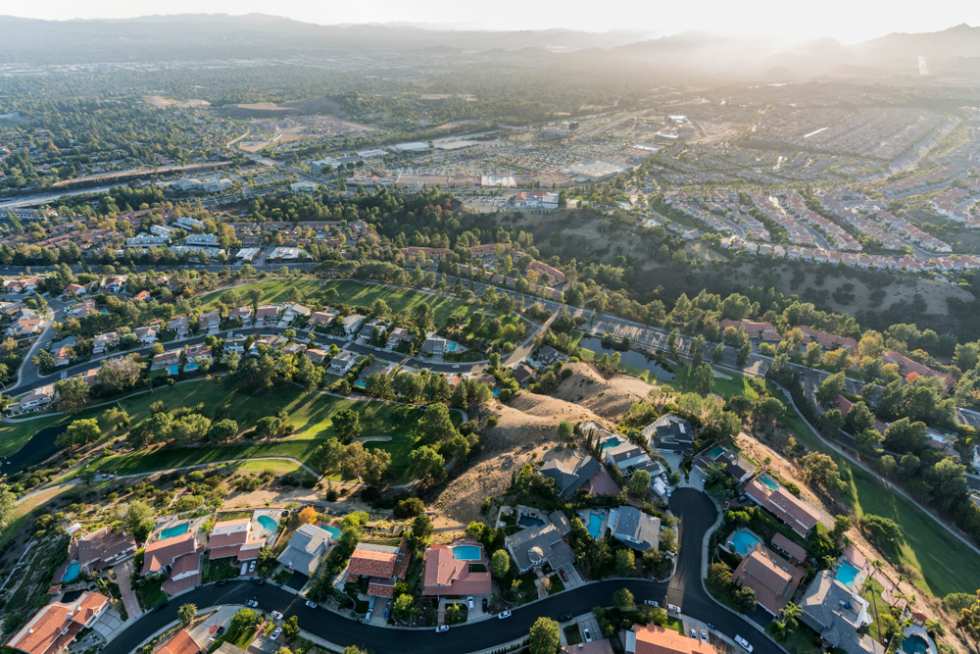
Porter Ranch is a peaceful, master-planned community in the northwest San Fernando Valley, perfect for renters seeking suburban calm and extra space. Known for its upscale homes, gated enclaves, and top-ranked public schools, it offers scenic mountain views and weekend-ready trails like Aliso Canyon and Limekiln.
The newly developed Vineyards at Porter Ranch adds modern shopping, dining, and a movie theater to the mix. While it’s quiet and clean, don’t expect city-style connectivity. Porter Ranch scores low on walkability, bikeability, and transit, making a car essential. The average rent is higher than many LA suburbs, but for those prioritizing safety, serenity, and family-friendly living, Porter Ranch is a standout,
Check out our listings in Porter Ranch
Anchored by UCLA, Westwood blends collegiate energy with cultural sophistication. Renters here enjoy access to the Hammer Museum, the Geffen Playhouse, and an impressive lineup of restaurants, bookstores, and coffee shops. Walkable streets and strong transit access make it easy to get around without a car, especially along Wilshire Boulevard. It’s also one of LA’s most desirable neighborhoods, which helps justify its sky-high rents.
Proximity to Beverly Hills, Century City, and Santa Monica means shorter commutes for professionals in law, entertainment, or tech. That said, Westwood’s popularity drives pricing through the roof, especially for newer or luxury units.
Check out our listings in Westwood
The Westside isn’t just a place, it’s a lifestyle. Encompassing hot spots like Sawtelle, Palms, and parts of Culver City, this area draws renters with its bustling food scenes, proximity to major employers, and quick access to beaches, studios, and startups.
Walk and bike scores are strong, and commutes to Santa Monica or West LA offices are some of the best in the city. But despite the perks, renters should note: crime grades are also the lowest of the best. Petty theft and car break-ins are common, and rents are sky-high, especially near tech corridors. Still, if you’re looking for energy, accessibility, and all the urban essentials packed into one zone, Westside living delivers.
Check out our listings in Westside
Eagle Rock is where small-town charm meets Eastside cool. In between Pasadena and Glendale, it’s a favorite for creatives, families, and long-time locals. The neighborhood is dotted with vintage shops, indie cafes, and gastropubs, with Colorado Boulevard serving as the main artery. Occidental College gives it an academic edge, while nearby parks and the occasional art walk create a laid-back, community-driven vibe.
Walkability is decent, though public transit is limited. Rental prices are still reasonable compared to Silver Lake or [Highland Park](https://www.apartmentlist.com/ca/los-angeles/neighborhoods/highland-park\), but rising demand is pushing competition up. Crime remains relatively low, especially for Northeast LA. If you’re looking for friendly neighbors, mid-century homes, and a slower pace without sacrificing personality, Eagle Rock is a top contender.
Check out our listings in Eagle Rock
Brentwood offers upscale tranquility on LA’s Westside, making it a go-to for renters who want tree-lined streets, ocean breezes, and a touch of old Hollywood. Its appeal lies in local gems like the Brentwood Country Mart, peaceful parks, and easy access to hiking in the Santa Monica Mountains.
Rents here are surprisingly affordable compared to nearby Pacific Palisades or Westwood. It's also one of the cleanest and safest areas in LA. That said, low walk and transit scores mean you’ll need a car for most errands. Still, with strong schools, quiet streets, and a vibe that mixes old-money elegance with boho wellness, Brentwood gives you a serene base with quick access to beaches and the 405.
Check out our listings in Brentwood
Mar Vista strikes a balance between residential calm and Westside activity. Bordered by Venice and Culver City, it gives renters access to bike paths, weekend farmers markets, and art-walk energy without the crowds. Its grid of bungalows and low-rise apartments attracts families and creatives looking for something quieter but still close to the action.
The area boasts strong bike infrastructure and a decent walk score, plus proximity to Santa Monica, LAX, and tech employers in Playa Vista. Rent prices are mid-tier for the Westside, though crime grades sit squarely in the average range. Still, Mar Vista remains a favorite for those seeking a grounded, community-first vibe that’s close to everything but rarely feels chaotic.
Check out our listings in Mar Vista
Located just north of LAX and home to Loyola Marymount University, Westchester offers a suburban feel with convenient access to airport jobs, Silicon Beach, and the 405. Tree-lined streets, single-family homes, and mid-century apartments define its residential zones. It’s relatively quiet, making it ideal for students, professionals, and families alike.
Commute times to the South Bay or Playa Vista are among the shortest in LA, and amenities like Westchester Park and Otis College bring in local flavor. Rent is more affordable than in Santa Monica or Culver City, though nightlife and walkability are limited. Public transit options are sparse, and most errands require a car. Still, if you’re after safety, space, and proximity to the coast, Westchester delivers.
Check out our listings in Westchester
| Neighborhood | Overall Crime Score | Average 1BR Rent | Commute to DTLA |
|---|---|---|---|
| Porter Ranch | A | $2,917 | 35 minutes |
| Westwood | C+ | $4,785 | 23 minutes |
| Westside | C | $4,239 | 19 minutes |
| Eagle Rock | B | $2,423 | 17 minutes |
| Brentwood | B | $1,866 | 25 minutes |
| Mar Vista | B- | $2,825 | 24 minutes |
| Westchester | B | $3,305 | 31 minutes |
Among the safest LA neighborhoods, rent varies dramatically, with monthly prices in Westwood averaging over $4,700, while Brentwood hovers closer to $1,866 for a one-bedroom. That’s a difference of over $2,800 per month for areas that both rank well on safety and amenities.
Even so, higher rent doesn’t always correlate with lower crime. However, many wealthier areas like Brentwood, Bel Air, and Pacific Palisades have more private security and gated properties.
We calculated LA commute times (2025) from each ranked neighborhood to three major job hubs. Car times reflect typical weekday traffic (8–9:30am), and Metro estimates use official route data.
From Porter Ranch:
From Westwood
From Westside
From Eagle Rock
From Brentwood
From Mar Vista
From Westchester
Not all neighborhoods feel the same at night, even when the crime stats look good on paper. That’s due to what criminologists call the “diurnal crime swing,” the way crime rates fluctuate over a 24-hour period.
Certain areas are safe by day but see sharp increases in incidents after dark, especially near nightlife corridors or under-policed zones. Others maintain consistently low crime rates regardless of the hour.
Neighborhoods like Bel Air and Encino stand out for having minimal nighttime incidents, largely thanks to low population density, gated streets, and strong community surveillance. In contrast, more active districts like Hollywood or parts of Downtown may appear statistically average but carry higher after-dark risk for pedestrians, renters, and rideshare users.
Safety isn’t one-size-fits-all. Some renters want quiet, suburban streets, while others need nightlife, walkability, or studio access. Here’s how to balance safety with your daily routine, without sacrificing convenience or cost.
If you're car-free but still want peace of mind, these neighborhoods offer strong safety scores and public transit access:
For added flexibility, these neighborhoods also support first-last-mile solutions—tools that help bridge the gap between transit stops and home. Think e-scooters, bike shares, and local microtransit apps that make short-distance travel safer and smoother.
You don’t need to live in a super high-end neighborhood or way out in ‘nowheresville’ to feel safe. Several rising neighborhoods are showing strong safety improvements, and still offer reasonable rents:
Key indicators include:
Not all streets are created equal. Even in “safe” neighborhoods, your exact address matters. Here’s how to vet a block before committing:
Doing your homework upfront helps you avoid surprises, and gives you real confidence in your new place.
Westwood puts you right next to campus, but Brentwood and Rancho Park also offer sub-15-minute commutes with “Very Safe” or better scores on our 2025 index.
Yes, while most neighborhoods dip after dark due to increased property crime, areas like Bel Air, Encino, and Porter Ranch maintain consistent safety day and night.
Use the LAPD Crime Mapping Tool, plug in the address, and filter for crimes within a 0.1-mile radius over the past 6–12 months.
Look for smart locks, video doorbells, and motion-sensor lighting—they deter break-ins and may help you qualify for lower renters insurance rates.

Patio / balcony, Pet friendly, Parking, Gym, Pool, Dog park + more
In unit laundry, Nest technology, Patio / balcony, Hardwood floors, Dishwasher, Pet friendly + more